
More coastal flooding with high rip currents expected this weekend
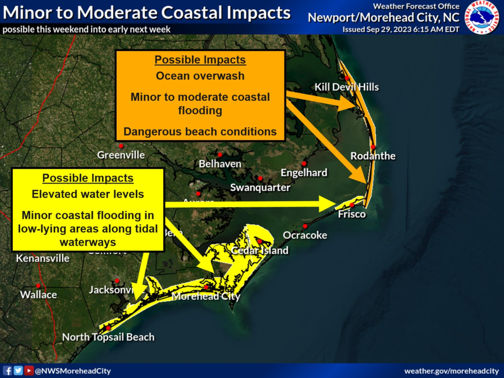
The office of National Weather Service Newport/Morehead City has warned of another risk of coastal flooding for this weekend, which can carry on into the initial period of next week.
Northeasterly onshore flow will continue to strengthen in the upcoming days of this warning period, with the peak of the current king tide cycle, leading to elevated water levels for portions of the Outer Banks, as well as an increased rip current risk with dangerous large breaking waves.
The highest water levels are expected with the morning high tide on Sunday at approximately 9:30 AM, and on Monday at approximately 10:15 AM.
Ocean overwash is predicted from Cape Point in Buxton to the northern Outer Banks with minor flooding for southern Hatteras, Ocracoke Islands.
Related: Outer Banks on alert for high tide by Central Flood Advisory
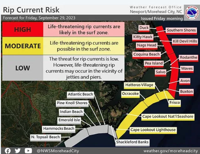
For beach visitors, it is highly advised to stay updated with the following official resources for rip current risk levels and other hazards along the shoreline;
1) https://www.weather.gov/beach/mhx
2) Dare County’s Love The Beach, Respect The Ocean: https://www.lovethebeachrespecttheocean.com/
3) National Weather Service office in Newport/Morehead City’s Facebook page: https://www.facebook.com/NWSMoreheadCity/